Geophysical Site investigations
An important step in de-risking marine projects is a detailed understanding of the seabed and underground. Geophysical site investigations are the foundation of qualitative ground models. As geophysical experts we aim to deliver the best results in the most optimal timeframe.
Seismic surveys
The choice of seismic systems driven by the scope of the project
Shallow Sub-bottom profiling seismics for cable and pipeline engineering
2D UHRS and 3D UHRS with deep penetration and highly detailed results for foundation engineering
Refraction seismics resulting in marine bedrock characterization for landfalls and dredging scopes
The combination of Shallow water and land seismics for a seamless coverage of the cable landing areas.
As every project and its requirements are unique, our geophysical experts can propose dedicated solutions to be put in place to ensure that our expertise meets the criteria.
UXO Detection surveys
G-tec Magwing multi gradient systems being steered with the help of Remotely Towed Operated Vehicle provide a full coverage of the survey area, reducing the need for infill lines.
Acquisition of Multibeam Echosounder and Side Scan Sonar is being performed in the same single pass.
Master target list
Our in house geophysical experts provide an in-depth interpretation of the geophysical data. Cross referencing the various geophysical and historical data results in a Master Target List of potential UXO’s.
This approach results in a very low ratio of “false positives” for potential UXO’s, and thus reduces the duration and costs for the following UXO identification campaign.
Identification and removal
ALARP If required an Identification & Removal campaign is set-up to ensure the critical areas are free of UXO’sALARP certificates are issued by the competent EOD expert
BOULDER DETECTION
Boulder detection surveys detect the presence of boulders above and below the seabed using acoustic methods and multiple seismic sources
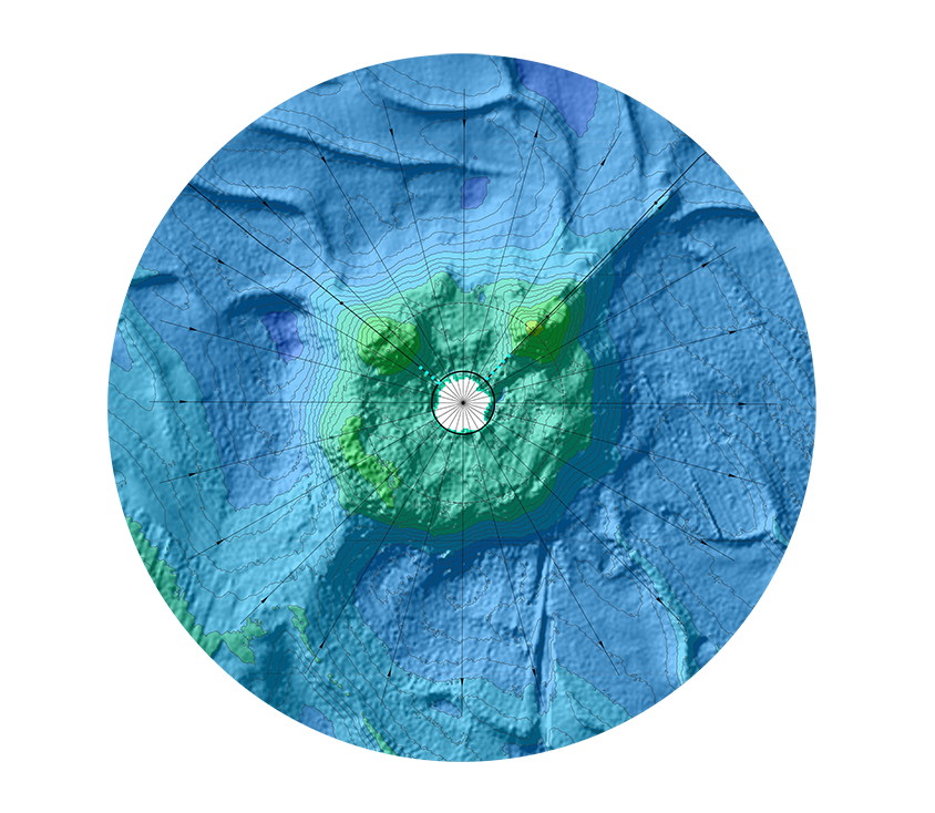
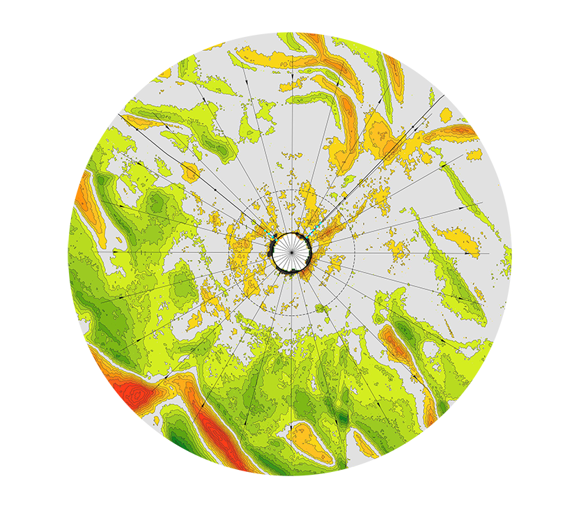
Seabed characterisation
- Multibeam echosounding surveys provide highly accurate bathymetry maps and Digital Terrain Models
- Side Scan Sonar provides full coverage acoustic images of the seabed. These images are used for UXO detection, object detection, boulder detection and classification of the seabed morphology
- Magnetometry provides important information on the seabed and geological formations.
- Advanced interpretation and cross-correlation of geophysical and geotechnical data result in advanced deliverables
Asset integrity
For underwater asset inspections a combination of Multibeam and Side-ScanSnar is being deployed while sailing the required area from survey vessel or USV.
For visual inspection of assets ROV’s can be deployed and equipped with additional tools for physical inspection of the assets.
Above the waterline assets are mapped using LIDAR, 3D camera and mapping systems on aerials drones or on vessels for a single pass acquisition above and below the water line.
Using our GIS systems, both under- and above water results are seamlessly combined into one model.
Typical applications for offshore asset integrity surveys are cables, pipelines, foundations of turbines, substations and O&G platforms. Onshore and on waterways the typical assets are river bridges, dams, locks…
Smart Data
After a first on board Quality Control, the latest data communication systems enable us to transmit the acquired data to the processing center for further processing and interpretation.
This results in a short turnaround time between acquisition and validation of the data.
Using our own online GIS dashboard, employers can be swiftly informed on the state of the survey and potential geo-hazards. This work flow enables decisions on design and layout changes during the survey, and thus reducing the costs and optimizing the value for the project.
Fleet
G-tec’s versatile survey vessels have been designed and equipped to minimize transition time between projects. On most projects all methods can be carried out in in a single pass.
The on board equipment is the most modern and state of the art available in the industry.