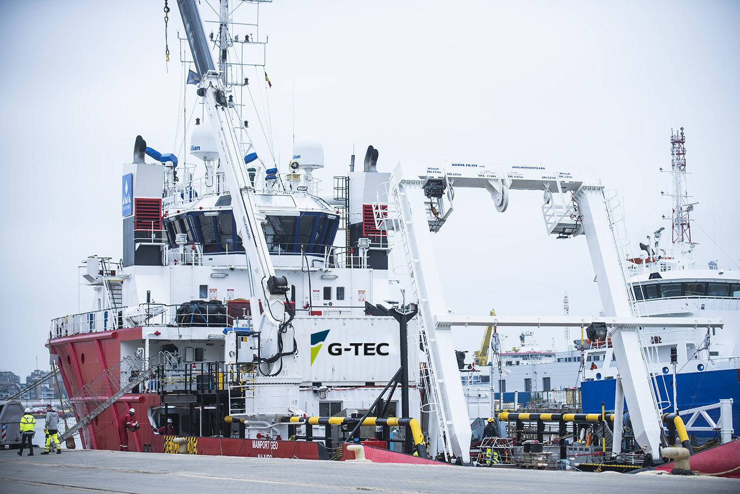
Following robust demand as the offshore wind industry continues to grow, DEME’s subsidiary G-tec has signed a multi-year charter agreement with Irish Mainport Holdings for its DP2 survey vessel “Mainport Geo”
The new vessel will enable G-TEC to further enhance its sit e investigation techniques.
At 50 m, ‘Mainport Geo’ underwent an extensive modification in 2021, which included fitting it with a 15-tonne A-frame, a robust side pole, a hull-mounted dual head Kongsberg multibeam and survey rooms.
De-risk projects
“By having an asset like this we are helping marine players de-risk their projects by providing valuable insight, allowing them to take informed decisions. G-tec collects huge amounts of data, which is generated by multiple advanced sensors and then processed and interpreted by our team of experts. This data is combined with our smart analytic workflows to deliver vital information to our customers,” says Thibaut Debouche, G-tec General Manager. “They can use this information in the development, preparation, engineering and construction phases of offshore wind projects.”
Actionable insight
“We aim to deliver the right information, at the right time. And to collect this data, we need the right vessel equipped with the most advanced sensors in the industry.”
‘Mainport Geo’ can be in the field for up to a month and G-tec is using the Starlink satellite system, which provides very high levels of connectivity with the office. “This superb connectivity is ideal when acquiring and processing gigabytes of data each day.”
ScotWind
G-tec deploys various advanced surveying techniques such as multibeam echo sounder, side scan sonar, single and multi-channel high resolution seismic surveys and a range of custom-made magnetometer arrays. The new vessel is the ideal size for North Sea conditions and is extremely stable and manoeuvrable, he points out, with a spacious deck and comfortable accommodation for 35 crew and survey specialists.
‘Mainport Geo’ will shortly be deployed to survey one of the ScotWind offshore wind farm sites.
Leveraging G-tec capabilities
G-tec is able to provide the data in near real-time via a web-based GIS portal. “Decision makers and engineers won’t have to wait weeks for a report.” Top quality information and qualitative data are required for the potential location of wind farms or where to place inter-array and export cables, Mr Debouche emphasises. “Working with G-tec allows them to plan well ahead. For example, if a survey reveals a significant geohazard in a cable route, then they may choose to adjust the survey layout in real time to avoid unnecessary costs and make sure useful data is obtained before leaving the site. This also leads to significant CO2 emission reductions as only valuable data is acquired. We are providing clients with actionable insight.”
About G-Tec
Based in Liege, Belgium, G-tec provides geophysical and GIS services for marine infrastructure projects around the world.


